This page follows the complete ten-book arc and contains series spoilers.

The road, one year at a time

The Journey

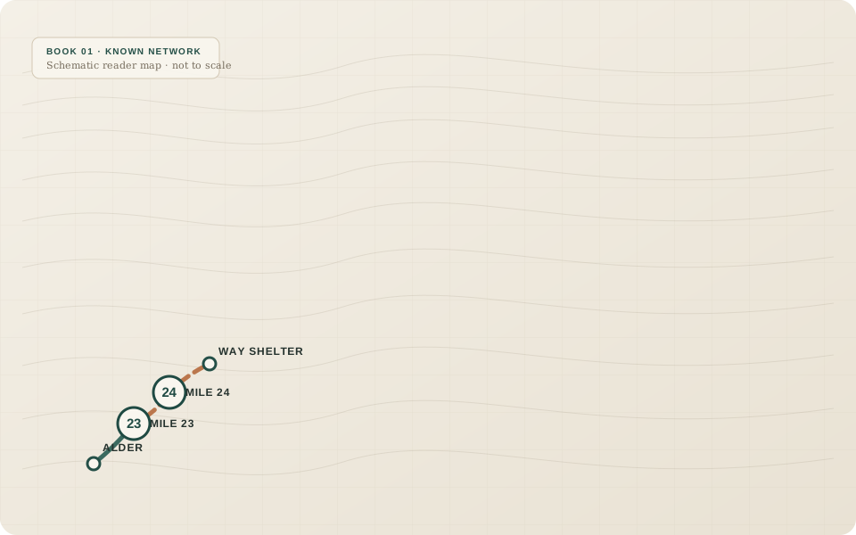
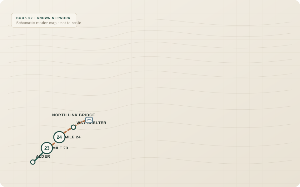
Each book covers one year of Sam Calder’s life. Each map shows only the network the story has earned by that point. The geography is schematic rather than to scale; the progression is the point.

Book 01 · Sam age 10

Mile Twenty-Four

Is it there?

Alder’s map and END OF ROAD sign say the same thing: the North Road stops at Mile 23. Sam follows the physical evidence anyway—ditch, pavement, old structures—and finds Mile 24 beyond the mapped edge. The road is real. The map is incomplete.

What changes: Sam learns to separate what people say from what the road itself can prove.

What carries forward: Mile 24 becomes the first piece of evidence the rest of the series must respect.

Book page →
01
Reader map for Book 1: Mile Twenty-Four

Book 02 · Sam age 11

The Bridge Beyond the End

Can I reach it and still turn back?

Sam and Mara push beyond Mile 24 toward the North Link bridge. Pack weight, daylight, water, weather, and return margin matter as much as the road itself. They turn around on time, then return with enough preparation to document the bridge and the road continuing beyond it.

What changes: Sam discovers that a good expedition can end with a voluntary turnaround and still move the larger question forward.

What carries forward: The route gains a name: NORTH LINK. The next question becomes “Link to what?”

Book page →
02
Reader map for Book 2: The Bridge Beyond the End

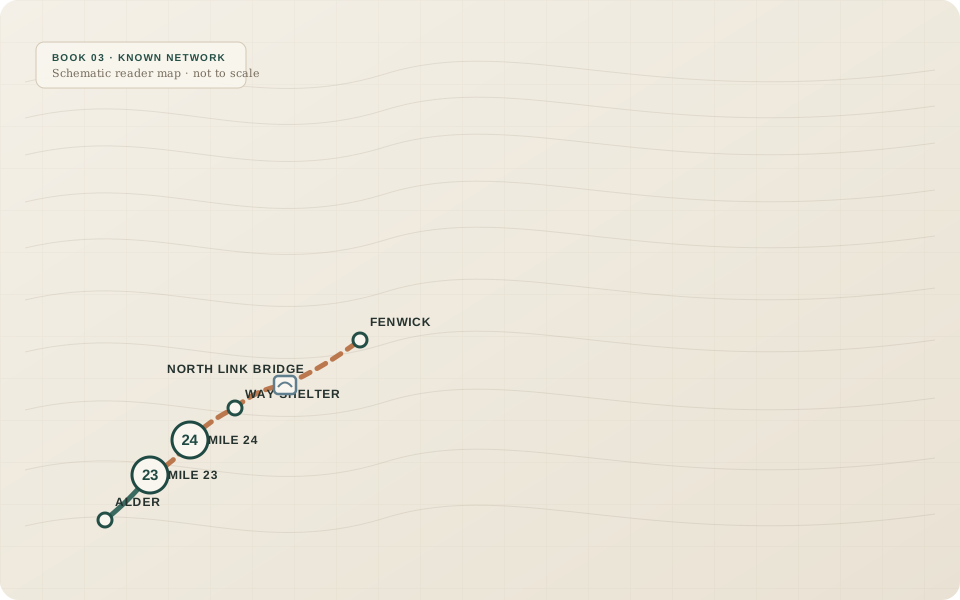
Book 03 · Sam age 12

The Town Off the Map

What actually happened?

Tracks and current road evidence lead north to Fenwick. Fenwick is ordinary, inhabited, maintained—and already has Alder on its own map. The towns remember the old closure differently. Sam’s first neat theory fails under records that are all real but incomplete.

What changes: Sam stops treating Alder’s map as the default truth and begins comparing records from both sides of the road.

What carries forward: Alder and Fenwick now have current contact. Their histories sit side by side instead of one replacing the other.

Book page →
03
Reader map for Book 3: The Town Off the Map

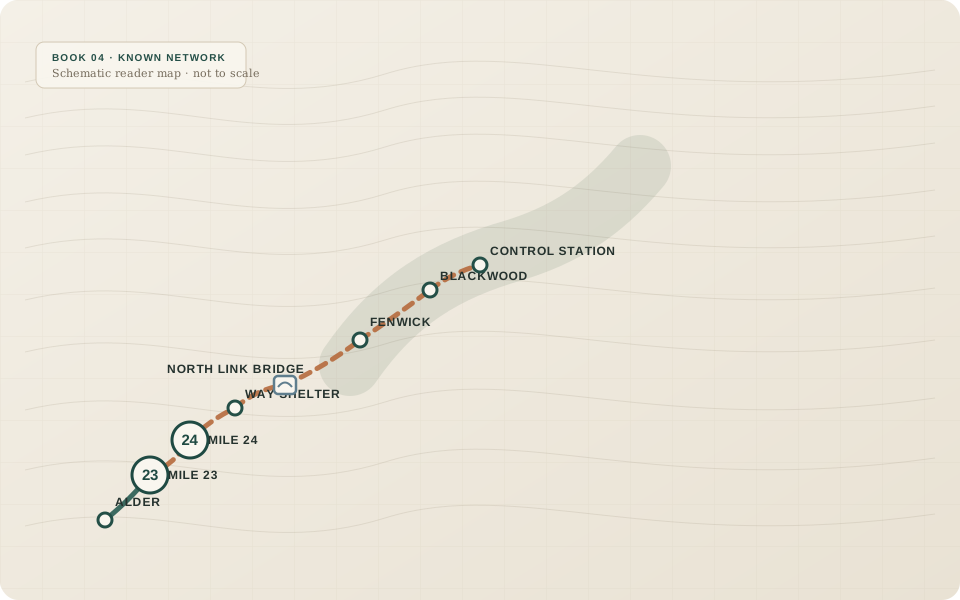
Book 04 · Sam age 13

The Road Through Blackwood

Which route is real?

Alder’s and Fenwick’s Blackwood records conflict. The Low Way carries flood risk; the High Line carries slope risk. Field evidence and old control-station material show that both warnings can be true in different contexts. The closure story expands beyond one town and one cause.

What changes: Conflicting evidence becomes something to classify, not something to force into one answer.

What carries forward: Blackwood proves Alder was only one participant in a larger regional system.

Book page →
04
Reader map for Book 4: The Road Through Blackwood

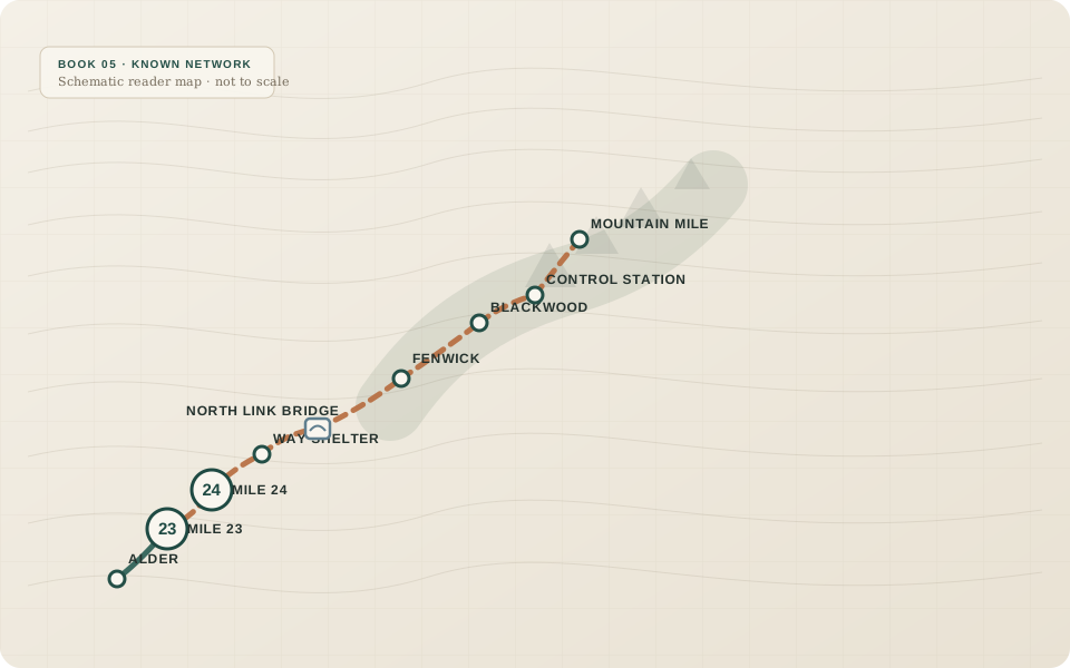
Book 05 · Sam age 14

The Mountain Mile

What does my decision cost when conditions change?

At Mountain Mile, the team reaches a broken approach and a mountain survey objective under Ruth’s safety authority. Sam argues for a short extension. Conditions then change. Mara is injured, and the descent makes the cost of margin physical without turning the original choice into obvious recklessness.

What changes: Sam begins to understand margin as something preserved for the unknown—not spare time waiting to be spent.

What carries forward: Trust changes into a new operating rule, and the surviving Compact material opens a new question: how did “temporary” last sixty years?

Book page →
05
Reader map for Book 5: The Mountain Mile

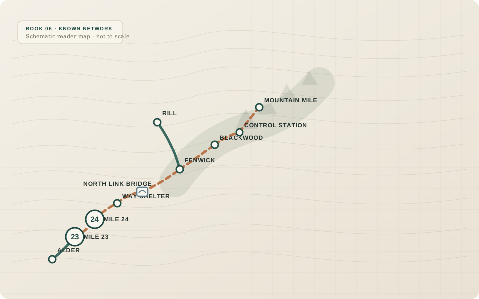
Book 06 · Sam age 15

The People Who Stayed

Can a route function as a system for other people?

Sam travels with an ordinary trade caravan to Rill. The important cargo is ordinary because that is exactly what connection changes. Rill has current roads, suppliers, businesses, and its own agency. Archive work shows no single day when “temporary” became permanent; shared responsibility simply fractured into local systems and then became normal.

What changes: The road stops being Sam’s discovery project and becomes infrastructure with economic and social consequences.

What carries forward: The map now looks like a network, not one road. The ending asks: ONE BRANCH OF WHAT?

Book page →
06
Reader map for Book 6: The People Who Stayed

Book 07 · Sam age 16

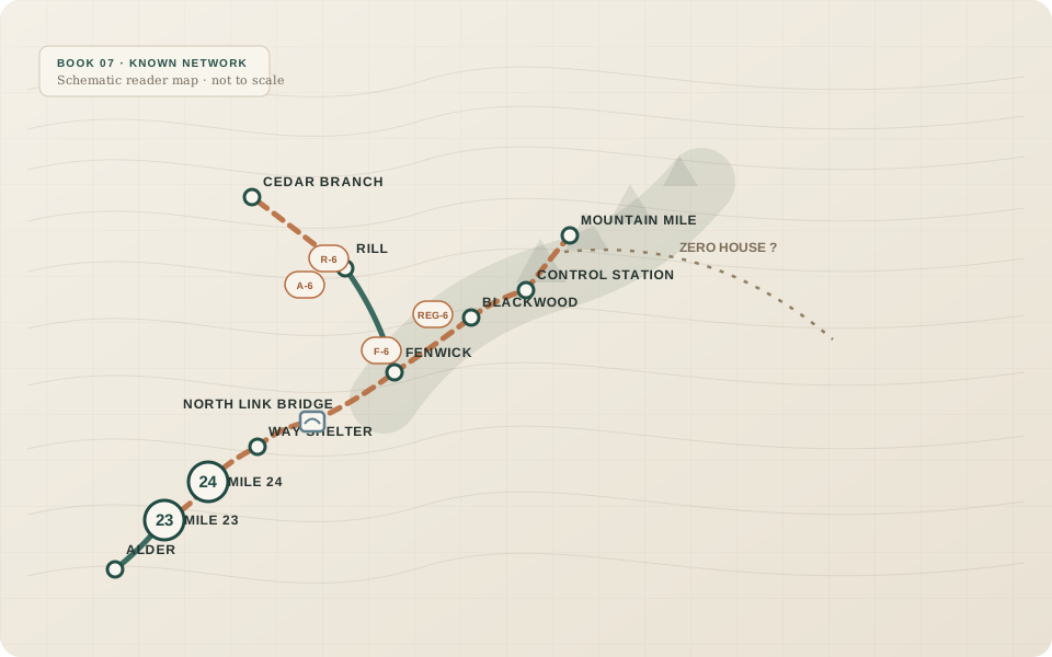
The Broken Map

Can several conflicting maps all be correct?

Alder, Fenwick, Rill, and the old regional system each use their own reference points. During the Cedar Branch search, June’s reading of Rill-local speech, landmarks, source maps, and route timing changes the search corridor. Later, Mile 23 is reinterpreted without being invalidated: the marker was right; Sam’s assumed numbering system was wrong.

What changes: Sam learns that a number means nothing useful until its reference system travels with it.

What carries forward: Version One becomes a layered map. A damaged survey index points toward a still-unresolved name: Zero House.

Book page →
07
Reader map for Book 7: The Broken Map

Book 08 · Sam age 17

The Far Side of the Pass

Can I trust evidence I did not personally gather?

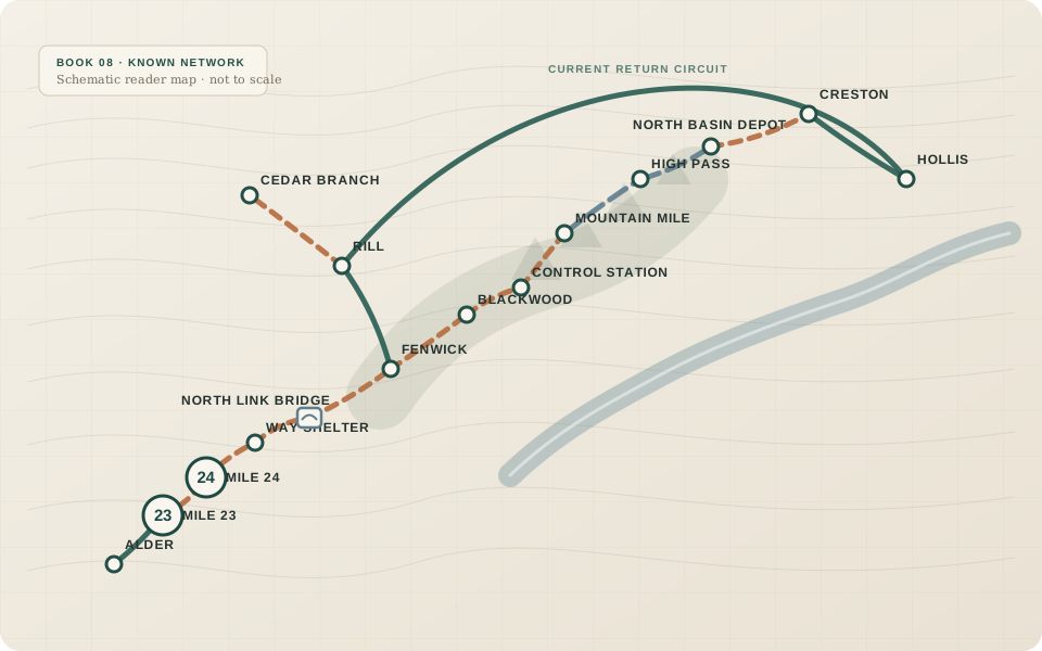
The expedition crosses High Pass, reconstructs a basin route, and reaches Creston and Hollis. Other teams gather evidence Sam cannot personally inspect. Northern archives preserve a five-year review expectation that southern copies lack, but uneven damage explains the difference better than a coordinated deletion. “The Compact expired” becomes an attractive question—not a magic reset.

What changes: Sam moves from personally checking everything to building a reliable chain of provenance, delegation, and review.

What carries forward: A late photograph reveals Zero House as a large regional transfer station where several roads came together.

Book page →
08
Reader map for Book 8: The Far Side of the Pass

Book 09 · Sam age 18

The First Marker

Does finding something give me permission or authority over it?

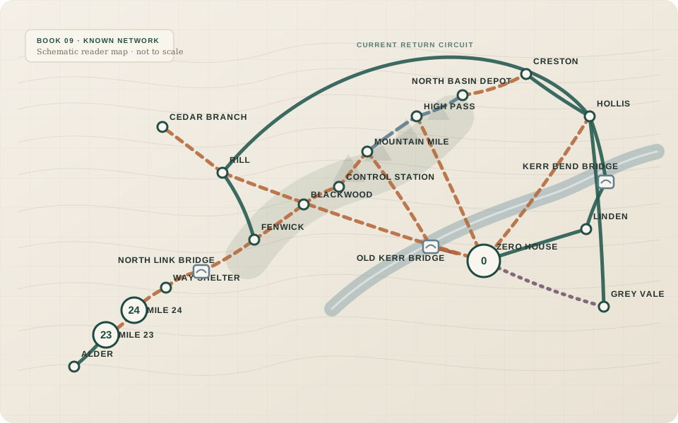
At Kerr River, the team can likely build a limited pedestrian span—but the immediate benefit would mostly be expedition convenience, while the crossing would create access and maintenance obligations. Sam recommends the long maintained route. At Zero House, Marker 0 is confirmed as the shared regional distance reference. It is not the beginning of the road network.

What changes: Leadership becomes stewardship: technical feasibility, community consent, publication, and maintenance are separate questions.

What carries forward: The fullest map is discovered, but sensitive current access is governed instead of mass-published.

Book page →
09
Reader map for Book 9: The First Marker

Book 10 · Sam age 19

Where the Road Begins

Who will maintain this after I leave?

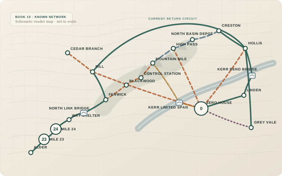
The Kerr span is built only after both banks accept inspection, closure, load, and maintenance responsibility. It closes when the river reaches the agreed threshold, then reopens after inspection and repair. At Zero House, communities create a Regional Road Compact with annual route-status review, five-year compact review, publication rules, maintenance assignments, and deliberate ways for roads to stay closed without being forgotten.

What changes: Sam’s final progression is from discovering roads to helping build systems that do not depend on him.

What carries forward: The series returns to Mile 24. Sam turns south toward Alder because the road no longer needs him to keep proving it exists.

Book page →
10
Reader map for Book 10: Where the Road Begins

End of series

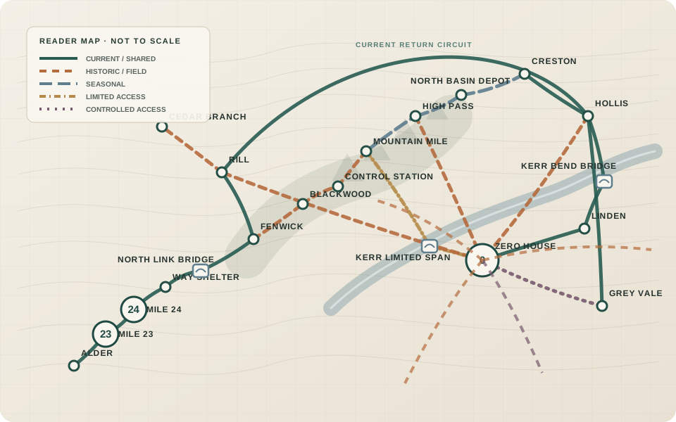
The complete reader map

By Book 10 the missing North Road has become a network of current, historic, seasonal, broken, and controlled routes. The final map deliberately keeps those categories visible instead of drawing every discovered line as if it were equally open.

Complete Journey schematic reader map

Map note: This is a reader-facing schematic derived from the manuscripts, not a literal surveyed map. Relative placement is designed to preserve story logic and route relationships without inventing precision the books do not establish.